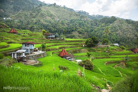
About Mayoyao
Mayoyao, officially the Municipality of Mayoyao is a 4th class municipality in the province of Ifugao, Philippines. According to the 2020 census, it has a population of 15,621 people.
History of Mayoyao
Battle of Mayoyao Bridge
From July 26, to August 9, 1945, Filipino soldiers under the command of Donald Blackburn, supported by airstrikes by Army Air Forces, captured the Japanese stronghold of Mayoyao, Ifugao in Northern Luzon
The memorial or historical marker, located at Mount Nagchajan in Mayoyao, Ifugao, marks the site of the “Battle of Mayoyao Ridge”. The battle was fought between the Japanese Imperial forces and the combined Filipino and American soldiers, towards the end of World War II. The result was key to the eventual surrender of General Yamashita at Kiangan, Ifugao.
Landmass
The municipality has a land area of 238.05 square kilometers or 91.91 square miles which constitutes 9.09% of Ifugao's total area. Its population as determined by the 2020 Census was 15,621. This represented 7.53% of the total population of Ifugao province, or 0.87% of the overall population of the Cordillera Administrative Region. Based on these figures, the population density is computed at 66 inhabitants per square kilometer or 170 inhabitants per square mile.
Government
Mayoyao is politically subdivided into 27 barangays. These barangays are headed by elected officials: Barangay Captain, Barangay Council, whose members are called Barangay Councilors. All are elected every three years.
Barangays
- Aduyongan
- Alimit
- Ayangan
- Balangbang
- Banao
- Banhal
- Bongan
- Buninan
- Chaya
- Chumang
- Guinihon
- Inwaloy
- Langayan
- Liwo
- Maga
- Magulon
- Mapawoy
- Mayoyao Proper
- Mongol
- Nalbu
- Nattum
- Palaad
- Poblacion
- Talboc
- Tulaed
- Bato-Alatbang
- Epeng